Our new paper, “Heavy metal imprints in Antarctic snow from research and tourism“, is published in Nature Sustainability (IF: 27.1).
The paper can be downloaded at https://www.nature.com/articles/s41893-025-01616-7.
Authors: Raúl R. Cordero, Sarah Feron, Avni Malhotra, Alessandro Damiani, Minghu Ding, Francisco Fernandoy, Juan A. Alfonso, Belkis Garcia, Juan M. Carrera, Pedro Llanillo, Paul Wachter, Jaime Pizarro, Elise Roumeas, Edgardo Sepúlveda, Jose Jorquera, Chenghao Wang, Jorge Carrasco, Zutao Ouyang, Pedro Oyola, Maarten Loonen, Anne Beaulieu, Jacob Dana, Alia L. Khan, Gino Casassa, & Choong-Min Kang
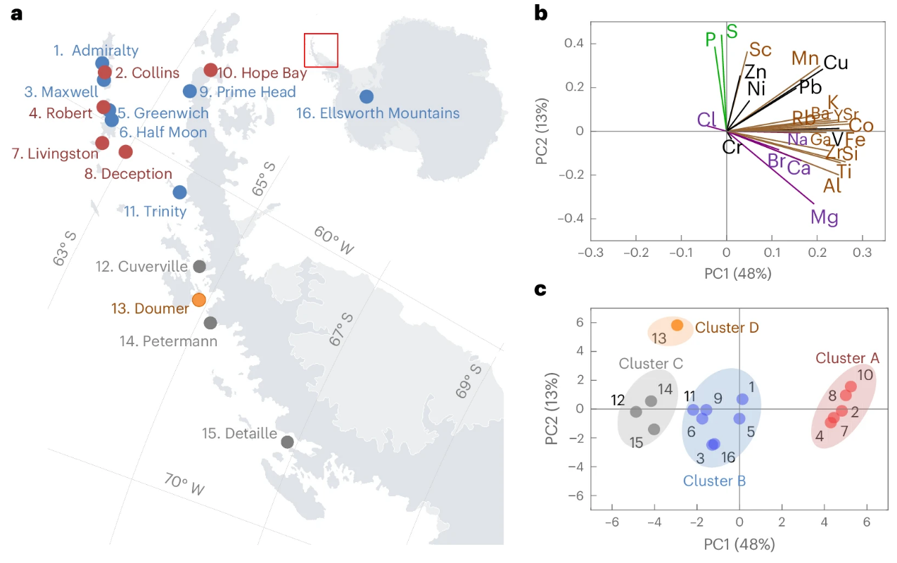
Abstract: Antarctica, long regarded as one of the last pristine environments on Earth, is increasingly affected by human activity. As tourism surges and scientific operations expand, air pollution from local emissions is raising new environmental concerns. Here we analyse surface snow samples collected along a ~2,000-km transect, from the South Shetland Islands (62° S) to the Ellsworth Mountains (79° S), to map the geochemical fingerprints of aerosol deposition. We identify distinct spatial patterns shaped by crustal, marine, biogenic and anthropogenic sources. Notably, we detect heavy metal imprints in the snow chemistry of the northern Antarctic Peninsula, where major research stations are concentrated and marine tourism traffic is most intense. Our findings shed light on the extent of the impacts from energy-intensive local activities in Antarctica, underscoring the need for enhanced environmental monitoring and sustainable management strategies in this fragile region.
DOI: https://doi.org/10.1038/s41893-025-01616-7